Ecosystem Spotlight: The Albertine Rift
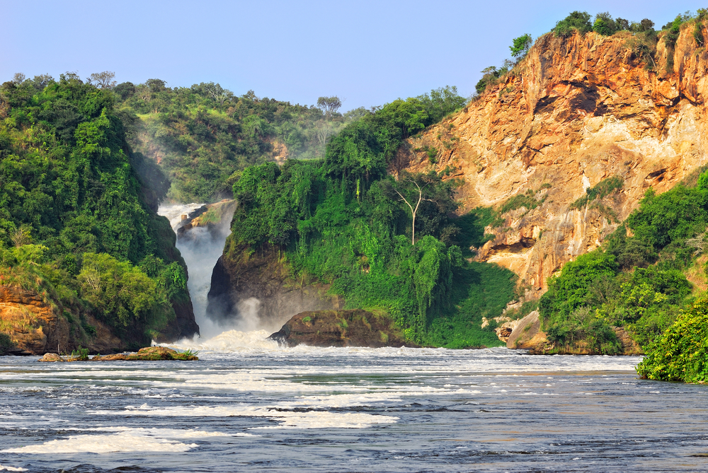
The Albertine Rift is the 920-mile long western area of the East African Rift, covering parts of Uganda, the Democratic Republic of the Congo, Rwanda, Burundi and Tanzania. It runs from the northern end of Lake Albert to the southern end of Lake Tanganyika. Formed over millions of years, the Albertine Rift is the result of two tectonic plates that once collided and are now slowly moving apart. This geologic activity has created some of Africa's tallest mountains and many of the world's deepest lakes. In addition, the unique variation in elevations has contributed to the diversity of habitats that include wetlands, alpine grasslands, lowland and montane forests, and woodland savannas. Within these habitats, one finds everything from active glaciers to volcanoes.
In particular, the montane forest ecoregion is the most fertile and biodiverse region within all of Africa. This ecosystem is rich in rainfall and volcanic soil, and has many varying microclimates within its borders. It includes transitional forests, which cover areas between lowland and montane forest, and are found at elevations from around 3,300 feet to 5,200 feet. From around 5,200 feet to 8,000 feet, montane forest covers the mountainsides. Above 8,000 feet, there are areas of bamboo and elfin forest. Heather and grasses dominate the zones above 11,500 feet. With more than half of Africa’s birds, 40% of Africa’s mammals and about 20% of its amphibians and plants, the Albertine Rift has been named a biodiversity hotspot. There are more threatened and endemic species here than in any other region of Africa, and as a result it has been designated a crucial ecoregion by the World Wildlife Fund, and an Endemic Bird Area by BirdLife International. It is home to the endangered endemic mountain gorilla, okapis, lions, primates, hippopotamuses, elephants, butterflies, plus dozens of rare bird and fish species.
Human populations are diverse, culturally rich, and large. There are over 2000 people per square mile in some areas. People have seen extensive conflict over the past 40 years with many civil wars. This combination of conflict, high population density, acute levels of poverty, and high biodiversity has created challenges for conservation in the area. CSF, in partnership with the Uganda National Environmental Management Authority, has begun work in this region, focusing on conserving ecosystems within the context of infrastructure development. CSF is working to minimize the impact of new roads, dams and oil exploration. To find out more about the Albertine Rift, please see the following websites: http://www.eoearth.org/article/Albertine_Rift http://www.albertinerift.org/ http://www.esri.com/news/arcnews/winter0910articles/monitoring-the-albertine.html http://ngm.nationalgeographic.com/2011/11/albertine-rift/draper-text http://www.birdlife.org/datazone/ebafactsheet.php?id=97 http://www.worldwildlife.org/science/wildfinder/ http://books.google.ca/books?id=N6FkwMnSX8EC&pg=PA164#v=onepage&q&f=false
- Log in to post comments